Result description
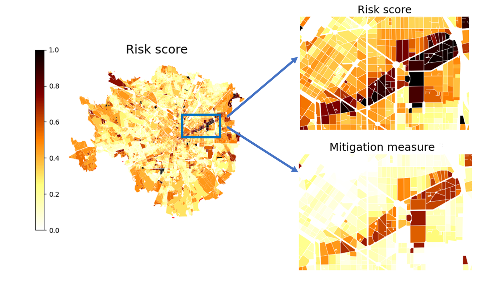
Taking as inputs the Exposure and Hazard data for the area of interest and a list of mitigation measures, the HARMONIA multi-hazards DSS provides as output Risk and Vulnerability maps (Spatially variable risk and vulnerability estimates for a particular area given certain hazard scenarios and risk changes due to the implementation of different mitigation measures). The major benefit is that the final user obtains hazard map for a certain event/hazard scenario affecting the urban area. In addition, the system shows how certain mitigation measure could impact the risk. This contributes to more effective risk-awareness decision-making processes and risk reduction eventually leading to the long-term cost reduction and performance improvement.
 Adaptation to climate change
 Climate-neutral and smart cities
Addressing target audiences and expressing needs
- To raise awareness and possibly influence policy
- Help in technical expertise
- Use of research Infrastructure
- pilot cities that want to be part of our network
- technical officials within the involved municipalities (final end-users) who want to collaborate to test and refine the service
- insurance companies and banks (potential end-users) who want to be introduced in the stakeholders’ network
- EU and Member State Policy-makers
- Research and Technology Organisations
- Academia/ Universities
R&D, Technology and Innovation aspects
Achievements until now:
- Use of DL models, developed within the project, to produce consistent, reliable and up-to-date information about urban areas in the pilot cities
- Analysis of the spatiotemporal patterns/trends of all risks that are covered in this project including UHI, flooding, etc.
- Converting risk trends to guidelines for city stakeholders and to be used in the Global Assessment Report
- Definition of a Indicator – based methodology for vulnerability and risk assessment: for individual perils the vulnerability component accounts for Physical vulnerability, Social Vulnerability, Coping Capacity
Next Steps:
- Vulnerability and CC indicators for all the perils considered by the HARMONIA project, e.g. flash floods, urban heat fluxes, geohazards, air quality, urban fires
- Risk score for all the perils considered by the HARMONIA project utilizing the hazard and exposure data provided by the partners
- Application of the developed vulnerability and risk assessment methodology in a number of BB at the demo sites, as illustrative examples, for all perils