
Result description
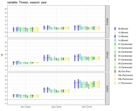
The Climate Scenarios for Integrated Modelling consist of harmonised, bias-corrected, and well-documented multi-model climate datasets developed to support integrated modelling of water and agricultural systems. These datasets provide a consistent and reliable climate data foundation across European regions and case studies, ensuring comparability of climate impact analyses.
The result includes validated climate projections, bias-correction algorithms, metadata documentation, reliability maps, and user guidance to facilitate correct interpretation and integration into modelling workflows. The datasets are accessible through the OPTAIN Learning Environment and open-access repositories.
By ensuring harmonised data formats, transparency, and scientific robustness through partnerships with European climate data providers, the Climate Scenarios enhance the credibility of modelling results and support evidence-based climate adaptation and water management planning.
Addressing target audiences and expressing needs
- To raise awareness and possibly influence policy
• Climate adaptation and agri-tech startups: to use the bias-corrected, high-resolution climate datasets for precision modelling and farm-level decision tools.
• Water management authorities: to apply ensemble projections for planning and implementing nature-based solutions.
• Impact investors: to support SDG-aligned investments delivering measurable climate-resilience outcomes.
- EU and Member State Policy-makers
R&D, Technology and Innovation aspects
The Climate Scenarios are fully developed, validated and integrated into the OPTAIN Learning Environment and open repositories. They are operational and available for integrated modelling use. The next steps focus on regular dataset updates, continued validation, interoperability maintenance, and integration into future European research and policy initiatives to ensure long-term sustainability.
The dataset uses standardized formats (NetCDF, CSV) and domain-specific structuring, enabling seamless integration across diverse European regions and linkage to platforms like ZENODO, ERA5-Land, and climate modelling tools for broader geographic and thematic expansion.
Its modular workflow, bias correction, interpolation, ensemble analysis, is adaptable across contexts and compatible with other climate datasets, ensuring methodological interoperability and easy replication for new catchments, sectors, or policy frameworks.
Public availability via ZENODO ensures long-term accessibility; transparent documentation and community engagement foster reuse, extension, and integration into future EU projects, educational programs, and regional climate adaptation strategies.
- Global
- Europe